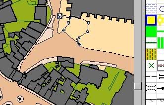
I can now convert large areas (several square km) into Ocad8 street or country (base) maps (not templates) in a few minutes, with a resolution of centimetres.
Is this useful?
Is it covered by 'based on OS mapping...' on the map and BO/OS agreements?
Moderators: [nope] cartel, team nopesport
![]() by martin » Sun Mar 29, 2009 9:22 pm
by martin » Sun Mar 29, 2009 9:22 pm

![]() by madmike » Sun Mar 29, 2009 9:28 pm
by madmike » Sun Mar 29, 2009 9:28 pm


![]() by martin » Sun Mar 29, 2009 9:46 pm
by martin » Sun Mar 29, 2009 9:46 pm
![]() by Wayward-O » Sun Mar 29, 2009 11:34 pm
by Wayward-O » Sun Mar 29, 2009 11:34 pm


![]() by Angry Haggis » Mon Mar 30, 2009 12:08 am
by Angry Haggis » Mon Mar 30, 2009 12:08 am
Wayward-O wrote:Pity there are no contours or it could be VERY useful.

![]() by martin » Mon Mar 30, 2009 11:12 am
by martin » Mon Mar 30, 2009 11:12 am
![]() by rob f » Mon Apr 06, 2009 7:05 pm
by rob f » Mon Apr 06, 2009 7:05 pm

![]() by DavidJ » Thu Jul 09, 2009 10:48 pm
by DavidJ » Thu Jul 09, 2009 10:48 pm
martin wrote:A short while ago I discovered that OS1250 maps of half of England are available on the ELGIN website as scaleable vector graphics files.
I can now convert large areas (several square km) into Ocad8 street or country (base) maps (not templates) in a few minutes, with a resolution of centimetres.
![]() by martin » Fri Jul 10, 2009 9:26 am
by martin » Fri Jul 10, 2009 9:26 am
![]() by geomorph » Fri Jul 10, 2009 2:21 pm
by geomorph » Fri Jul 10, 2009 2:21 pm
![]() by Marco Polo » Fri Jul 10, 2009 3:10 pm
by Marco Polo » Fri Jul 10, 2009 3:10 pm
![]() by martin » Fri Jul 10, 2009 3:25 pm
by martin » Fri Jul 10, 2009 3:25 pm
Users browsing this forum: No registered users and 8 guests
